Asia / City maps
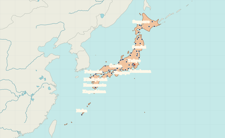
Map of Japan with cities
Follow Japan’s island chain from Sapporo through Tokyo and Osaka to Fukuoka. Find Naha on Okinawa, southwest of the four main islands. City index (69) · Map questions
JapanCity map
● Capital● City
Reading the map
From Hokkaido to the Ryukyu Islands
Start at Sapporo on Hokkaido and follow the islands southwest. Sendai and Tokyo sit on the Pacific side of Honshu. Farther west, Kyoto lies inland from Osaka Bay. For the southern end of the map, find Kagoshima on Kyushu and Naha on Okinawa.
| City | Direction | Straight-line distance |
|---|---|---|
| Sapporo | North | 833 km / 518 mi |
| Ōsaka | West | 401 km / 249 mi |
| Fukuoka | West | 885 km / 550 mi |
| Sendai | North | 304 km / 189 mi |
Japan map questions
Which Japanese islands are Tokyo, Sapporo and Naha on?
Tokyo is on Honshu, the main island. Sapporo is on Hokkaido to the north, and Naha is on Okinawa far to the southwest.
How far apart are Sapporo and Ōsaka?
Ōsaka is about 1,060 km (659 mi) southwest of Sapporo in a straight line between their map markers. Road distances depend on the route.
Cities on this map (69)
- Akita
- Aomori
- Asahikawa
- Fukui
- Fukuoka
- Fukushima
- Gifu
- Hachinohe
- Hachiōji
- Hakodate
- Hamamatsu
- Hirosaki
- Hiroshima
- Iwaki
- Kagoshima
- Kanazawa
- Kanoya
- Kawagoe
- Kawasaki
- Kitakyūshū
- Kitami
- Kumamoto
- Kure
- Kushiro
- Kyoto
- Kōbe
- Kōchi
- Kōfu
- Kōriyama
- Maebashi
- Maizuru
- Matsue
- Matsumoto
- Matsuyama
- Mito
- Miyazaki
- Morioka
- Muroran
- Nagano
- Nagaoka
- Nagasaki
- Nagoya
- Naha
- Niigata
- Obihiro
- Okayama
- Otaru
- Sakata
- Sapporo
- Sasebo
- Sendai
- Shimonoseki
- Shizuoka
- Takamatsu
- Takaoka
- Tokushima
- Tokyo
- Tomakomai
- Tottori
- Toyama
- Tsu
- Tsuruoka
- Utsunomiya
- Wakayama
- Yamagata
- Yokohama
- Ōita
- Ōsaka
- Ōtsu