United States / City maps
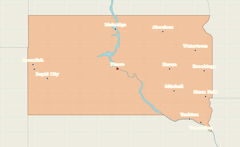
Map of South Dakota with cities
Compare Pierre on the Missouri with Rapid City near the Black Hills and Sioux Falls in southeastern South Dakota. City index (13) · Map questions
South DakotaCity map
● Capital● City
Reading the map
The Missouri River and the Black Hills
Find Pierre on the Missouri River near the center of the state. Rapid City lies to the west at the edge of the Black Hills, with Spearfish farther northwest. Sioux Falls and Brookings lie on the eastern side near Minnesota.
| City | Direction | Straight-line distance |
|---|---|---|
| Sioux Falls | East | 304 km / 189 mi |
| Rapid City | West | 232 km / 144 mi |
| Aberdeen | Northeast | 191 km / 119 mi |
| Brookings | East | 283 km / 176 mi |
South Dakota map questions
Which South Dakota city is closer to the Black Hills?
Rapid City lies at the eastern edge of the Black Hills. Sioux Falls is across the state near Minnesota, while Pierre sits between the two on the Missouri River.
How far apart are Sioux Falls and Rapid City?
Rapid City is about 525 km (326 mi) west of Sioux Falls in a straight line between their map markers. Road distances depend on the route.
Cities on this map (13)
- Aberdeen
- Brookings
- Huron
- Lead
- Mitchell
- Mobridge
- Pierre
- Rapid City
- Sioux Falls
- Spearfish
- Vermillion
- Watertown
- Yankton