United States / City maps
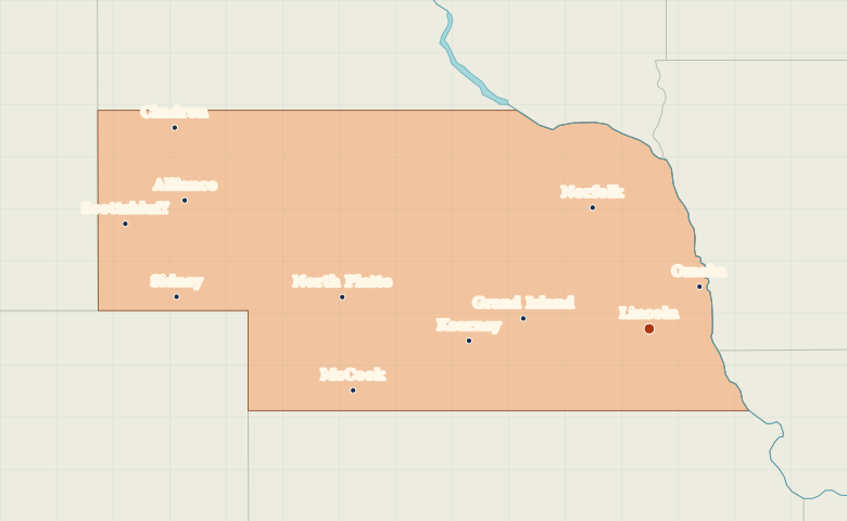
Map of Nebraska with cities
Locate Lincoln and Omaha in eastern Nebraska, follow Platte Valley cities westward, and find Scottsbluff near Wyoming. City index (11) · Map questions
NebraskaCity map
● Capital● City
Reading the map
The Platte Valley and the Panhandle
Lincoln lies southwest of Omaha, away from the Missouri River border. Follow the broad Platte Valley west through Grand Island, Kearney and North Platte. Scottsbluff and Chadron mark the western Panhandle.
| City | Direction | Straight-line distance |
|---|---|---|
| Omaha | Northeast | 73 km / 45 mi |
| Grand Island | West | 142 km / 88 mi |
| Kearney | West | 203 km / 126 mi |
| North Platte | West | 345 km / 214 mi |
Nebraska map questions
Which Nebraska cities mark the Platte Valley?
Follow North Platte, Kearney and Grand Island from west to east. Scottsbluff sits farther west on the North Platte River in the Panhandle.
How far apart are Omaha and Grand Island?
Grand Island is about 200 km (124 mi) west of Omaha in a straight line between their map markers. Road distances depend on the route.
Cities on this map (11)
- Alliance
- Chadron
- Grand Island
- Kearney
- Lincoln
- McCook
- Norfolk
- North Platte
- Omaha
- Scottsbluff
- Sidney