United States / City maps
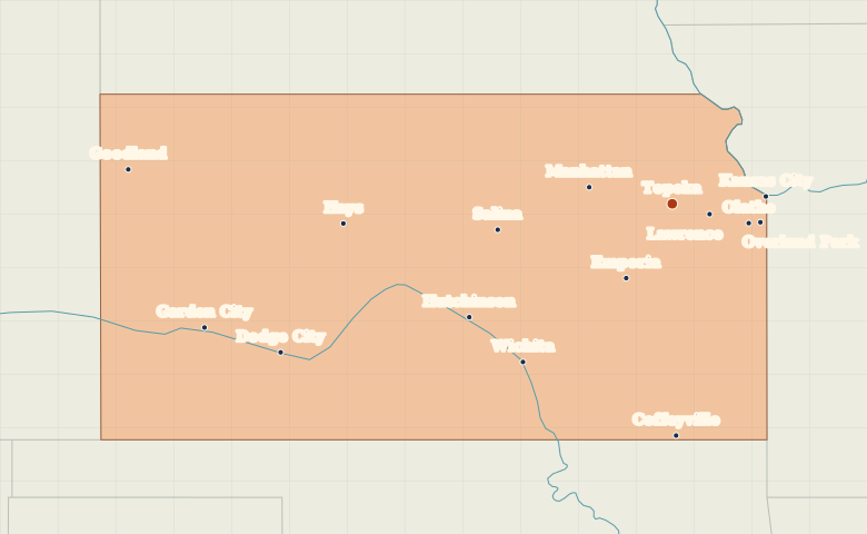
Map of Kansas with cities
Locate Topeka, Lawrence and Kansas City in northeastern Kansas, then find Wichita to the south and Garden City on the western plains. City index (15) · Map questions
KansasCity map
● Capital● City
Reading the map
The Kansas River and the western plains
Start in the northeast with Topeka, Lawrence and Kansas City along the Kansas River. Wichita lies farther south. To explore western Kansas, locate Dodge City and Garden City on the Arkansas River and Goodland near the Colorado border.
| City | Direction | Straight-line distance |
|---|---|---|
| Wichita | Southwest | 210 km / 131 mi |
| Kansas City | East | 90 km / 56 mi |
| Lawrence | East | 37 km / 23 mi |
| Dodge City | West | 405 km / 252 mi |
Kansas map questions
Where is Kansas City on the Kansas state map?
Kansas City is on the eastern state line, east of Lawrence and Topeka. The larger city with the same name is on the Missouri side of the border.
How far apart are Wichita and Kansas City?
Kansas City is about 284 km (177 mi) northeast of Wichita in a straight line between their map markers. Road distances depend on the route.
Cities on this map (15)
- Coffeyville
- Dodge City
- Emporia
- Garden City
- Goodland
- Hays
- Hutchinson
- Kansas City
- Lawrence
- Manhattan
- Olathe
- Overland Park
- Salina
- Topeka
- Wichita