United States / City maps
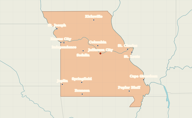
Map of Missouri with cities
Find Kansas City and St. Louis on opposite sides of Missouri, Jefferson City on the Missouri River and Springfield in the Ozarks. City index (14) · Map questions
Reading the map
Two big rivers and the Ozarks
Kansas City and St. Louis mark opposite sides of Missouri. Jefferson City sits on the Missouri River between them, south of Columbia. Look southwest to find Springfield and Joplin, then southeast to locate Cape Girardeau on the Mississippi.
| City | Direction | Straight-line distance |
|---|---|---|
| Kansas City | West | 219 km / 136 mi |
| St. Louis | East | 168 km / 104 mi |
| Springfield | Southwest | 185 km / 115 mi |
| Columbia | North | 44 km / 27 mi |
Missouri map questions
Which Kansas City does the Missouri map show?
The marker for Kansas City is on the Missouri side of the state line. Kansas City, Kansas, is a separate city across the border. St. Louis is at the opposite end of Missouri.
How far apart are Kansas City and St. Louis?
St. Louis is about 381 km (237 mi) east of Kansas City in a straight line between their map markers. Road distances depend on the route.
Cities on this map (14)
- Branson
- Cape Girardeau
- Columbia
- Independence
- Jefferson City
- Joplin
- Kansas City
- Kirksville
- Poplar Bluff
- Sedalia
- Springfield
- St. Charles
- St. Joseph
- St. Louis