United States / City maps
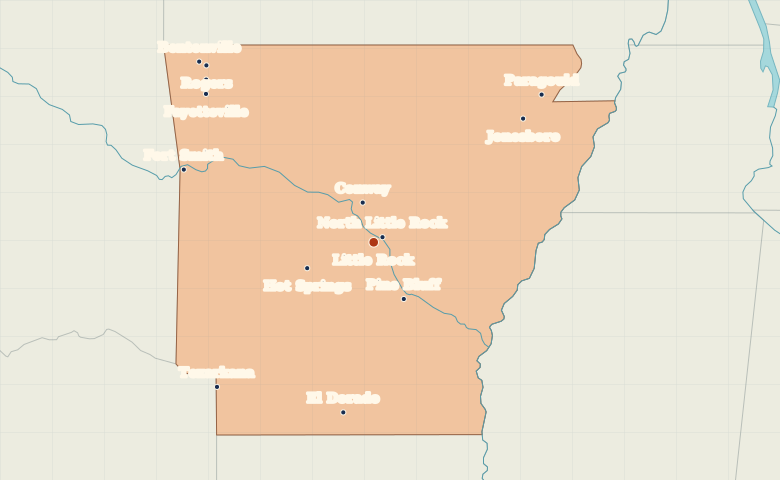
Map of Arkansas with cities
Locate Little Rock and North Little Rock across the Arkansas River, then find the northwestern cluster around Fayetteville and Bentonville. City index (14) · Map questions
Reading the map
From the Ozarks to the Arkansas River
Little Rock and North Little Rock face each other across the Arkansas River. Trace the river northwest toward Fort Smith on the Oklahoma border. Bentonville and Fayetteville lie north of Fort Smith, while Jonesboro anchors the northeast.
| City | Direction | Straight-line distance |
|---|---|---|
| Fayetteville | Northwest | 222 km / 138 mi |
| Fort Smith | West | 202 km / 125 mi |
| Jonesboro | Northeast | 192 km / 119 mi |
| Bentonville | Northwest | 249 km / 155 mi |
Arkansas map questions
How are Little Rock and North Little Rock positioned?
North Little Rock is across the Arkansas River from Little Rock. The two city centers are close together, so choosing a name in the index is easier than picking a dot at statewide scale.
How far apart are Fayetteville and Fort Smith?
Fort Smith is about 78 km (49 mi) south of Fayetteville in a straight line between their map markers. Road distances depend on the route.
Cities on this map (14)
- Bentonville
- Conway
- El Dorado
- Fayetteville
- Fort Smith
- Hot Springs
- Jonesboro
- Little Rock
- North Little Rock
- Paragould
- Pine Bluff
- Rogers
- Springdale
- Texarkana