United States / City maps
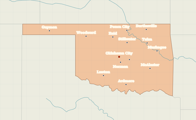
Map of Oklahoma with cities
Locate Guymon in Oklahoma’s Panhandle, then compare Oklahoma City and Norman with Tulsa in the northeast and Lawton in the southwest. City index (14) · Map questions
OklahomaCity map
● Capital● City
Reading the map
The Panhandle and the central cities
Guymon anchors the narrow Panhandle in the northwest. In the wider part of the state, find Oklahoma City and Norman just to its south. Tulsa lies to the northeast, Lawton to the southwest, and Ardmore near the Texas border.
| City | Direction | Straight-line distance |
|---|---|---|
| Tulsa | Northeast | 161 km / 100 mi |
| Guymon | West | 380 km / 236 mi |
| Lawton | Southwest | 126 km / 79 mi |
| Ardmore | South | 148 km / 92 mi |
Oklahoma map questions
Which city marks the Oklahoma Panhandle?
Guymon sits inside the long, narrow strip in northwestern Oklahoma. Compare it with Woodward, farther southeast in the wider part of the state.
How far apart are Tulsa and Guymon?
Guymon is about 501 km (311 mi) west of Tulsa in a straight line between their map markers. Road distances depend on the route.
Cities on this map (14)
- Ardmore
- Bartlesville
- Enid
- Guymon
- Lawton
- McAlester
- Muskogee
- Norman
- Oklahoma City
- Ponca City
- Shawnee
- Stillwater
- Tulsa
- Woodward