United States / City maps
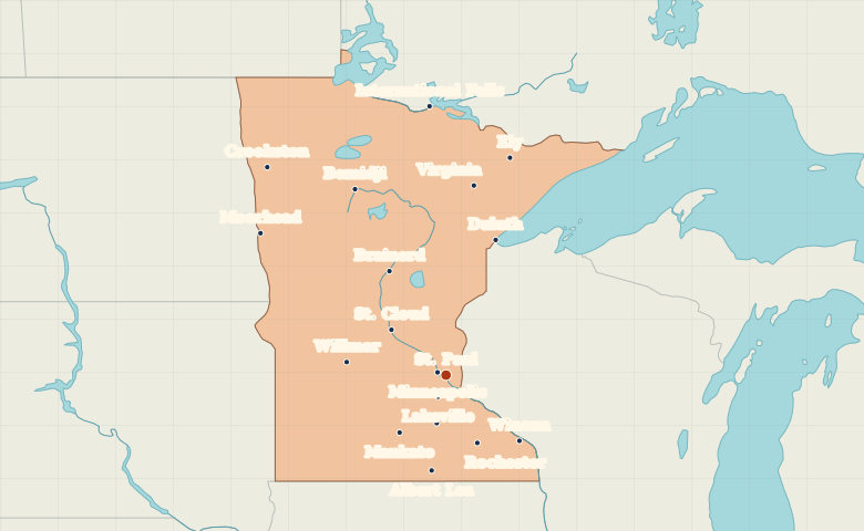
Map of Minnesota with cities
Find Minneapolis and St. Paul on the Mississippi, Duluth on Lake Superior and Moorhead on Minnesota’s border with North Dakota. City index (18) · Map questions
MinnesotaCity map
● Capital● City
Reading the map
The Twin Cities and the head of Lake Superior
Start with St. Paul and Minneapolis on the Mississippi River. Duluth marks the western tip of Lake Superior, while Moorhead sits on the North Dakota border. Rochester is southeast of the Twin Cities and Winona is farther east on the Mississippi.
| City | Direction | Straight-line distance |
|---|---|---|
| Minneapolis | West | 14 km / 9 mi |
| Duluth | North | 218 km / 136 mi |
| Rochester | Southeast | 114 km / 71 mi |
| Moorhead | Northwest | 355 km / 221 mi |
Minnesota map questions
Which of Minnesota’s Twin Cities is farther east?
St. Paul is east of Minneapolis. The two cities are close enough that their labels can overlap at state scale. Select either name to zoom in.
How far apart are Minneapolis and Duluth?
Duluth is about 219 km (136 mi) northeast of Minneapolis in a straight line between their map markers. Road distances depend on the route.
Cities on this map (18)
- Albert Lea
- Bemidji
- Brainerd
- Crookston
- Duluth
- Ely
- Faribault
- International Falls
- Lakeville
- Mankato
- Minneapolis
- Moorhead
- Rochester
- St. Cloud
- St. Paul
- Virginia
- Willmar
- Winona