United States / City maps
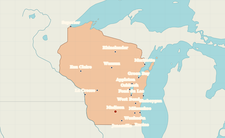
Map of Wisconsin with cities
Locate Milwaukee, Madison and Green Bay in Wisconsin, then compare Superior on Lake Superior with La Crosse on the Mississippi. City index (18) · Map questions
WisconsinCity map
● Capital● City
Reading the map
Lake Michigan, Lake Superior and the Mississippi
Find Milwaukee on Lake Michigan and Madison inland to its west. Green Bay marks the head of the bay that shares its name. Superior sits at the western end of Lake Superior, and La Crosse is on the Mississippi along Wisconsin’s western edge.
| City | Direction | Straight-line distance |
|---|---|---|
| Milwaukee | East | 121 km / 75 mi |
| Green Bay | Northeast | 197 km / 123 mi |
| Superior | Northwest | 458 km / 285 mi |
| La Crosse | Northwest | 169 km / 105 mi |
Wisconsin map questions
Where do Wisconsin’s two Great Lakes appear on the map?
Milwaukee is on Lake Michigan in the southeast. To find Lake Superior, look in the northwest at the city of Superior, across the water from Duluth, Minnesota.
How far apart are Milwaukee and Green Bay?
Green Bay is about 167 km (104 mi) north of Milwaukee in a straight line between their map markers. Road distances depend on the route.
Cities on this map (18)
- Appleton
- Eau Claire
- Fond du Lac
- Green Bay
- Janesville
- La Crosse
- Madison
- Marinette
- Milwaukee
- Oshkosh
- Racine
- Rhinelander
- Sheboygan
- Superior
- Tomah
- Waukesha
- Wausau
- West Bend