United States / City maps
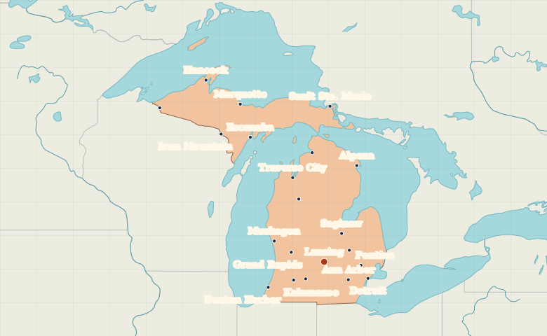
Map of Michigan with cities
Explore both Michigan peninsulas. Find Detroit and Grand Rapids on the Lower Peninsula and compare Marquette and Escanaba on the Upper Peninsula. City index (22) · Map questions
Reading the map
Cities on Michigan’s two peninsulas
Use the Great Lakes to orient the two peninsulas. Detroit, Lansing and Grand Rapids form an east-to-west sequence across the Lower Peninsula. On the Upper Peninsula, compare Marquette on Lake Superior with Escanaba on the Lake Michigan side.
| City | Direction | Straight-line distance |
|---|---|---|
| Detroit | East | 130 km / 81 mi |
| Grand Rapids | West | 95 km / 59 mi |
| Marquette | Northwest | 481 km / 299 mi |
| Traverse City | North | 242 km / 150 mi |
Michigan map questions
Which Michigan cities are on the Upper Peninsula?
Marquette, Escanaba and Sault Ste. Marie are on the Upper Peninsula. Traverse City is farther south on the Lower Peninsula, even though it is often associated with northern Michigan.
How far apart are Detroit and Grand Rapids?
Grand Rapids is about 225 km (140 mi) west of Detroit in a straight line between their map markers. Road distances depend on the route.
Cities on this map (22)
- Alpena
- Ann Arbor
- Battle Creek
- Bay City
- Benton Harbor
- Cadillac
- Detroit
- Escanaba
- Flint
- Grand Rapids
- Hancock
- Iron Mountain
- Ironwood
- Kalamazoo
- Lansing
- Marquette
- Muskegon
- Petoskey
- Pontiac
- Saginaw
- Sault Ste. Marie
- Traverse City