United States / City maps
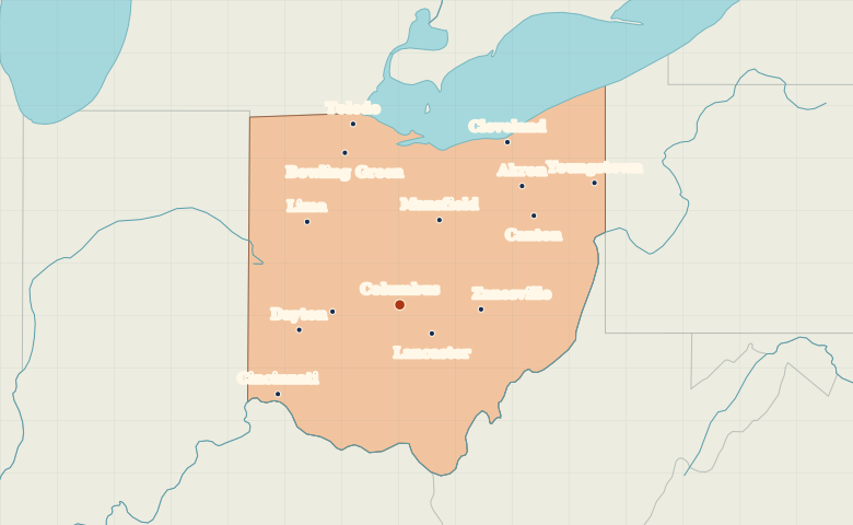
Map of Ohio with cities
Use Columbus to orient yourself in Ohio, then find Cleveland and Toledo on Lake Erie and Cincinnati on the Ohio River. City index (14) · Map questions
OhioCity map
● Capital● City
Reading the map
Lake Erie and the Ohio River cities
Start at Columbus near the middle of the state. Toledo and Cleveland mark two distinct points on Lake Erie. Cincinnati sits on the Ohio River in the southwest. Finding Dayton between Cincinnati and the northwest helps distinguish it from Akron, south of Cleveland.
| City | Direction | Straight-line distance |
|---|---|---|
| Cleveland | Northeast | 198 km / 123 mi |
| Cincinnati | Southwest | 155 km / 96 mi |
| Toledo | North | 190 km / 118 mi |
| Dayton | West | 106 km / 66 mi |
Ohio map questions
Which Ohio cities on the map are on Lake Erie?
Toledo lies at the western end of the lake and Cleveland sits farther east along its southern shore. Akron is inland, south of Cleveland.
How far apart are Cleveland and Cincinnati?
Cincinnati is about 347 km (216 mi) southwest of Cleveland in a straight line between their map markers. Road distances depend on the route.
Cities on this map (14)
- Akron
- Bowling Green
- Canton
- Cincinnati
- Cleveland
- Columbus
- Dayton
- Lancaster
- Lima
- Mansfield
- Springfield
- Toledo
- Youngstown
- Zanesville