United States / City maps
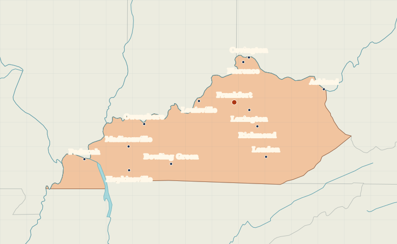
Map of Kentucky with cities
Find Frankfort between Lexington and Louisville, then compare Paducah in western Kentucky with Ashland at the northeastern edge. City index (13) · Map questions
KentuckyCity map
● Capital● City
Reading the map
The Ohio River cities and the Bluegrass region
Trace the Ohio River from Ashland in the northeast past Covington to Louisville and Owensboro. Inland, Frankfort sits between Louisville and Lexington. Bowling Green lies farther southwest, while Paducah marks the western end of this group of cities.
| City | Direction | Straight-line distance |
|---|---|---|
| Louisville | West | 77 km / 48 mi |
| Lexington | Southeast | 37 km / 23 mi |
| Paducah | West | 351 km / 218 mi |
| Bowling Green | Southwest | 193 km / 120 mi |
Kentucky map questions
Where does Frankfort sit between Louisville and Lexington?
Frankfort lies east of Louisville and northwest of Lexington. All three are in the northern part of Kentucky, well east of Paducah.
How far apart are Louisville and Lexington?
Lexington is about 111 km (69 mi) east of Louisville in a straight line between their map markers. Road distances depend on the route.
Cities on this map (13)
- Ashland
- Bowling Green
- Covington
- Florence
- Frankfort
- Hopkinsville
- Lexington
- London
- Louisville
- Madisonville
- Owensboro
- Paducah
- Richmond