United States / City maps
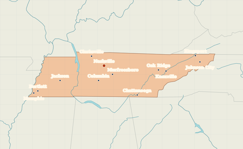
Map of Tennessee with cities
See where Memphis, Nashville, Knoxville and Chattanooga sit across Tennessee, from the Mississippi River to the cities of the east. City index (12) · Map questions
Reading the map
Three regions from Memphis to Knoxville
Tennessee stretches much farther east to west than north to south. Start with Memphis on the Mississippi River, then locate Nashville near the middle. In the east, Chattanooga sits close to the Georgia line, while Knoxville and Johnson City lie farther northeast.
| City | Direction | Straight-line distance |
|---|---|---|
| Memphis | West | 315 km / 196 mi |
| Knoxville | East | 258 km / 160 mi |
| Chattanooga | Southeast | 185 km / 115 mi |
| Johnson City | East | 397 km / 247 mi |
Tennessee map questions
Which Tennessee cities are farthest east on this map?
Johnson City and Kingsport sit in the northeastern part of the state, beyond Knoxville. Chattanooga is also in eastern Tennessee, but much farther south at the Georgia line.
How far apart are Memphis and Knoxville?
Knoxville is about 560 km (348 mi) east of Memphis in a straight line between their map markers. Road distances depend on the route.
Cities on this map (12)
- Bartlett
- Chattanooga
- Clarksville
- Columbia
- Jackson
- Johnson City
- Kingsport
- Knoxville
- Memphis
- Murfreesboro
- Nashville
- Oak Ridge