United States / City maps
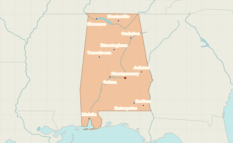
Map of Alabama with cities
Locate Huntsville in northern Alabama, Mobile on the coast, and the inland cities of Birmingham and Montgomery between them. City index (11) · Map questions
Reading the map
From the Tennessee Valley to Mobile Bay
Huntsville and Florence lie across the north of the state. Birmingham sits north of Montgomery, while Tuscaloosa lies west of Birmingham. Follow the map southwest to Mobile at the head of Mobile Bay or southeast to Dothan near the Florida and Georgia borders.
| City | Direction | Straight-line distance |
|---|---|---|
| Mobile | Southwest | 251 km / 156 mi |
| Huntsville | North | 264 km / 164 mi |
| Birmingham | North | 140 km / 87 mi |
| Florence | Northwest | 300 km / 187 mi |
Alabama map questions
Which Alabama city is on Mobile Bay?
Mobile lies at the northern end of Mobile Bay in the southwestern corner of Alabama. Dothan, the other prominent southern city on the map, lies much farther east and inland.
How far apart are Mobile and Huntsville?
Huntsville is about 469 km (291 mi) north of Mobile in a straight line between their map markers. Road distances depend on the route.
Cities on this map (11)
- Auburn
- Birmingham
- Dothan
- Enterprise
- Florence
- Gadsden
- Huntsville
- Mobile
- Montgomery
- Selma
- Tuscaloosa