United States / City maps
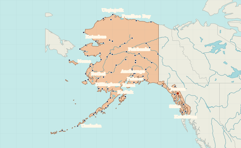
Map of Alaska with cities
Find Juneau on Alaska’s panhandle, Anchorage in the south-central region and Fairbanks in the Interior. Zoom out to compare coastal communities. City index (84) · Map questions
AlaskaCity map
● Capital● City
Reading the map
Cities of the Southeast, Interior and Arctic coast
Juneau and Ketchikan sit on the southeastern panhandle. Anchorage lies farther west at Cook Inlet, while Fairbanks is inland on the other side of the Alaska Range. Find Nome on the Seward Peninsula and Utqiaġvik on the Arctic coast.
| City | Direction | Straight-line distance |
|---|---|---|
| Anchorage | Northwest | 923 km / 574 mi |
| Fairbanks | Northwest | 1,008 km / 627 mi |
| Nome | Northwest | 1,766 km / 1,097 mi |
| Utqiaġvik | Northwest | 1,769 km / 1,099 mi |
Alaska map questions
Is Juneau near Anchorage on the Alaska map?
Juneau lies far southeast of Anchorage, in Alaska’s coastal panhandle. Fairbanks is north of Anchorage in the Interior.
How far apart are Anchorage and Fairbanks?
Fairbanks is about 417 km (259 mi) north of Anchorage in a straight line between their map markers. Road distances depend on the route.
Cities on this map (84)
- Allakaket
- Ambler
- Anchorage
- Aniak
- Atka
- Atqasuk
- Bethel
- Big Delta
- Cantwell
- Chignik
- Circle
- Cold Bay
- Cordova
- Denali Park
- Dillingham
- Eagle
- Emmonak
- Fairbanks
- False Pass
- Fort Yukon
- Galena
- Gambell
- Goodnews Bay
- Gulkana
- Homer
- Hoonah
- Hooper Bay
- Hughes
- Hydaburg
- Juneau
- Kaktovik
- Kaltag
- Karluk
- Kenai
- Ketchikan
- King Salmon
- Kivalina
- Kobuk
- Kodiak
- Kotlit
- Kotzebue
- Koyuk
- Koyukuk
- Lake Minchumina
- McGrath
- Mekoryuk
- Montana
- Mountain Village
- Nenana
- Newhalen
- Nikolski
- Nome
- Nyac
- Palmer
- Perryville
- Pilot Point
- Point Hope
- Port Heiden
- Prudhoe Bay
- Quinhagak
- Red Devil
- Sand Point
- Selawik
- Seward
- Shishmaref
- Sitka
- Skagway
- Talkeetna
- Tanacross
- Tanana
- Teller
- Togiak
- Tununak
- Unalakleet
- Unalaska
- Utqiaġvik
- Valdez
- Wainwright
- Wales
- Wasilla
- Whittier
- Wiseman
- Wrangell
- Yakutat