United States / City maps
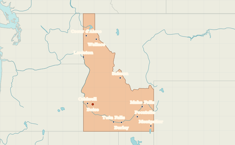
Map of Idaho with cities
Explore Idaho from Coeur d’Alene in the narrow north to Boise in the southwest. Follow the Snake River Plain toward Twin Falls and Idaho Falls. City index (11) · Map questions
IdahoCity map
● Capital● City
Reading the map
The northern lakes and the Snake River Plain
Find Coeur d’Alene in the narrow northern part of Idaho and Lewiston farther south along the Washington border. Boise and Caldwell form a southwestern pair. From Twin Falls, follow the sweep of the Snake River Plain toward Pocatello and Idaho Falls.
| City | Direction | Straight-line distance |
|---|---|---|
| Coeur d'Alene | North | 454 km / 282 mi |
| Lewiston | North | 318 km / 198 mi |
| Twin Falls | Southeast | 185 km / 115 mi |
| Idaho Falls | East | 338 km / 210 mi |
Idaho map questions
Which part of Idaho is Coeur d’Alene in?
Coeur d'Alene is in Idaho’s northern panhandle, near the Washington border. Boise is much farther south, in the wider southwestern part of Idaho.
How far apart are Coeur d'Alene and Lewiston?
Lewiston is about 141 km (88 mi) south of Coeur d'Alene in a straight line between their map markers. Road distances depend on the route.
Cities on this map (11)
- Boise
- Burley
- Caldwell
- Coeur d'Alene
- Idaho Falls
- Lewiston
- Montpelier
- Pocatello
- Salmon
- Twin Falls
- Wallace