United States / City maps
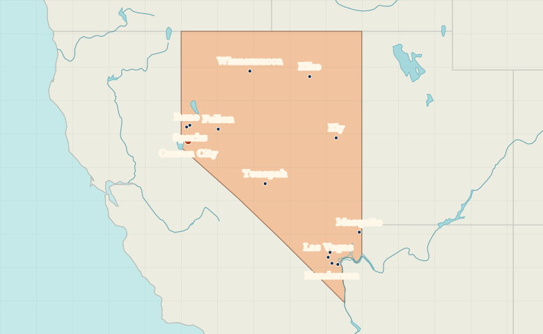
Map of Nevada with cities
Compare the Reno–Carson City area with Las Vegas and Henderson in southern Nevada. Find Ely, Elko and Tonopah across the interior. City index (13) · Map questions
NevadaCity map
● Capital● City
Reading the map
Lake Tahoe, the Great Basin and the Las Vegas Valley
Reno and Sparks sit just north of Carson City near the California border. Las Vegas and Henderson form a separate cluster at the southern end of the state. In between, use Tonopah and Ely to orient the wide interior.
| City | Direction | Straight-line distance |
|---|---|---|
| Las Vegas | Southeast | 525 km / 326 mi |
| Reno | North | 41 km / 25 mi |
| Henderson | Southeast | 545 km / 339 mi |
| Elko | Northeast | 388 km / 241 mi |
Nevada map questions
Which is closer to Lake Tahoe, Reno or Las Vegas?
Reno is much closer. Look near Carson City on Nevada’s western border to find the Tahoe area. Las Vegas is at the southern end of the state.
How far apart are Las Vegas and Reno?
Reno is about 555 km (345 mi) northwest of Las Vegas in a straight line between their map markers. Road distances depend on the route.
Cities on this map (13)
- Boulder City
- Carson City
- Elko
- Ely
- Fallon
- Henderson
- Las Vegas
- Mesquite
- North Las Vegas
- Reno
- Sparks
- Tonopah
- Winnemucca