United States / City maps
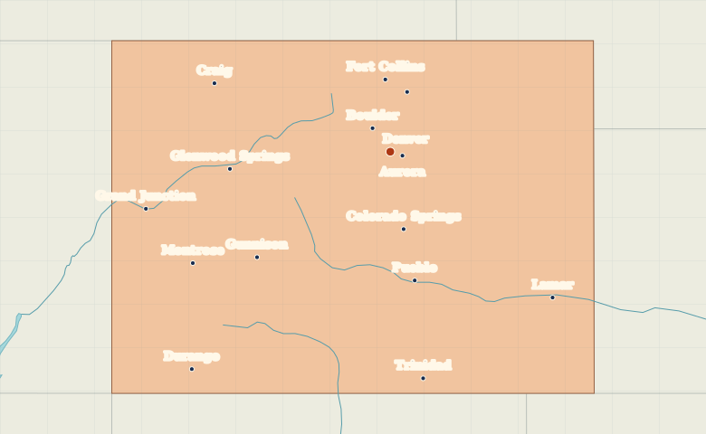
Map of Colorado with cities
See how Denver, Colorado Springs and Pueblo line up along Colorado’s Front Range, and locate Grand Junction on the other side of the mountains. City index (15) · Map questions
ColoradoCity map
● Capital● City
Reading the map
The Front Range and the Western Slope
Follow the Front Range from Fort Collins through Denver to Colorado Springs and Pueblo. Grand Junction sits west of the Continental Divide, while Durango marks the southwestern part of the state.
| City | Direction | Straight-line distance |
|---|---|---|
| Colorado Springs | South | 99 km / 62 mi |
| Grand Junction | West | 314 km / 195 mi |
| Durango | Southwest | 372 km / 231 mi |
| Fort Collins | North | 91 km / 57 mi |
Colorado map questions
Which Colorado cities are on the Front Range?
Follow Fort Collins, Denver, Colorado Springs and Pueblo from north to south along the eastern side of the Rockies. Grand Junction is across the mountains on the Western Slope.
How far apart are Colorado Springs and Grand Junction?
Grand Junction is about 326 km (202 mi) west of Colorado Springs in a straight line between their map markers. Road distances depend on the route.
Cities on this map (15)
- Aurora
- Boulder
- Colorado Springs
- Craig
- Denver
- Durango
- Fort Collins
- Glenwood Springs
- Grand Junction
- Greeley
- Gunnison
- Lamar
- Montrose
- Pueblo
- Trinidad