United States / City maps
Map of Delaware with cities
See where Dover sits between Wilmington and Delaware’s beach towns. Find Newark inland and Lewes near the mouth of Delaware Bay. City index (12) · Map questions
DelawareCity map
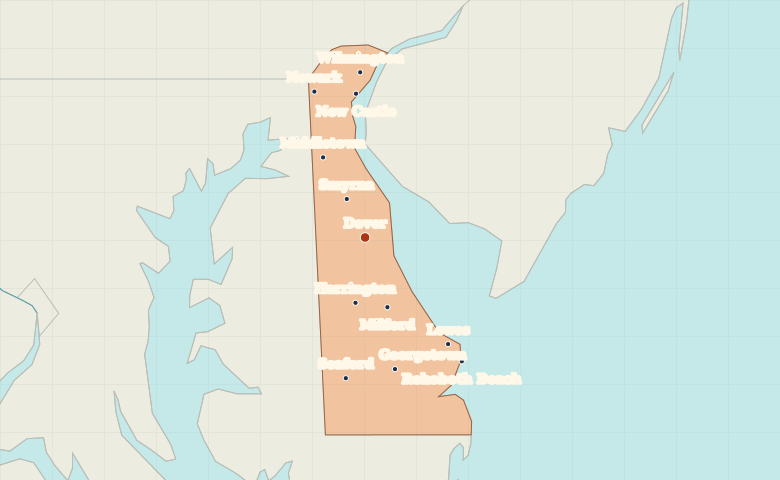
● Capital● City
Reading the map
From Wilmington to the Atlantic beaches
Wilmington and Newark form a northern pair near the Pennsylvania and Maryland borders. Follow the state south through Dover and Milford. The coastal cities of Lewes and Rehoboth Beach lie east of Georgetown and Seaford.
| City | Direction | Straight-line distance |
|---|---|---|
| Wilmington | North | 65 km / 41 mi |
| Newark | North | 61 km / 38 mi |
| Milford | South | 29 km / 18 mi |
| Lewes | Southeast | 53 km / 33 mi |
Delaware map questions
Where are Lewes and Rehoboth Beach relative to Dover?
Lewes and Rehoboth Beach are southeast of Dover. Lewes is near the mouth of Delaware Bay, while Rehoboth Beach lies farther south on the Atlantic.
How far apart are Wilmington and Newark?
Newark is about 19 km (12 mi) southwest of Wilmington in a straight line between their map markers. Road distances depend on the route.
Cities on this map (12)
- Dover
- Georgetown
- Harrington
- Lewes
- Middletown
- Milford
- New Castle
- Newark
- Rehoboth Beach
- Seaford
- Smyrna
- Wilmington