United States / City maps
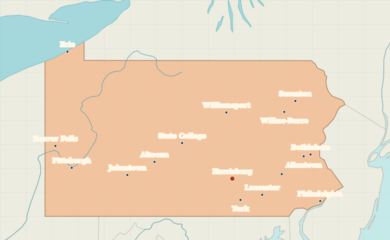
Map of Pennsylvania with cities
Find Philadelphia on the Delaware, Harrisburg on the Susquehanna and Pittsburgh in western Pennsylvania. Locate Erie on the Great Lakes shore. City index (16) · Map questions
Reading the map
From the Delaware River to Lake Erie
Philadelphia sits on the Delaware River in the southeast. Move west to Harrisburg on the Susquehanna, then across the state to Pittsburgh at the meeting of the Allegheny and Monongahela. Erie marks Pennsylvania’s short Great Lakes shoreline.
| City | Direction | Straight-line distance |
|---|---|---|
| Philadelphia | East | 150 km / 93 mi |
| Pittsburgh | West | 265 km / 164 mi |
| Erie | Northwest | 338 km / 210 mi |
| Scranton | Northeast | 163 km / 101 mi |
Pennsylvania map questions
Which Pennsylvania city is on a Great Lake?
Erie is on Lake Erie in Pennsylvania’s northwestern corner. Pittsburgh is farther south on the western side of the state, where the Allegheny and Monongahela rivers meet.
How far apart are Philadelphia and Pittsburgh?
Pittsburgh is about 413 km (257 mi) west of Philadelphia in a straight line between their map markers. Road distances depend on the route.
Cities on this map (16)
- Allentown
- Altoona
- Beaver Falls
- Bethlehem
- Erie
- Harrisburg
- Johnstown
- Lancaster
- Philadelphia
- Pittsburgh
- Reading
- Scranton
- State College
- Wilkes-Barre
- Williamsport
- York