United States / City maps
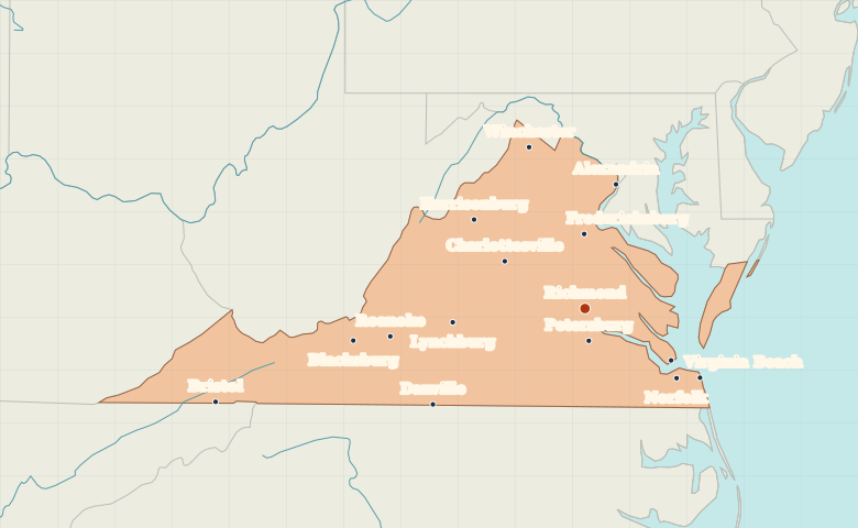
Map of Virginia with cities
Find Richmond between Virginia’s mountain valleys and the tidal waters of Hampton Roads. Locate Roanoke, Norfolk and Virginia Beach on the same map. City index (15) · Map questions
VirginiaCity map
● Capital● City
Reading the map
From the Shenandoah Valley to Hampton Roads
Locate Richmond, then follow the map southeast to Hampton Roads, where Hampton and Norfolk sit on opposite sides of the harbor. Farther west, Harrisonburg and Roanoke help trace the long southwest-to-northeast orientation of Virginia’s mountain valleys.
| City | Direction | Straight-line distance |
|---|---|---|
| Norfolk | Southeast | 130 km / 81 mi |
| Roanoke | West | 222 km / 138 mi |
| Harrisonburg | Northwest | 159 km / 99 mi |
| Alexandria | North | 143 km / 89 mi |
Virginia map questions
Where are the Hampton Roads cities on the Virginia map?
Look southeast of Richmond. Norfolk and Hampton sit on opposite sides of the harbor, and Virginia Beach extends east to the Atlantic.
How far apart are Norfolk and Roanoke?
Roanoke is about 328 km (204 mi) west of Norfolk in a straight line between their map markers. Road distances depend on the route.
Cities on this map (15)
- Alexandria
- Blacksburg
- Bristol
- Charlottesville
- Danville
- Fredericksburg
- Hampton
- Harrisonburg
- Lynchburg
- Norfolk
- Petersburg
- Richmond
- Roanoke
- Virginia Beach
- Winchester