United States / City maps
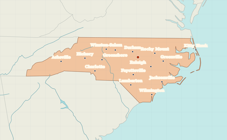
Map of North Carolina with cities
Explore North Carolina from Asheville in the Blue Ridge to Wilmington near the coast. Locate Charlotte, Raleigh and Durham along the way. City index (16) · Map questions
Reading the map
From the Blue Ridge to the Atlantic
Find Asheville in the western mountains, then move east through the Piedmont to Greensboro and the Raleigh–Durham area. Wilmington is on the Cape Fear River near the coast. Jacksonville lies farther northeast, and Kitty Hawk marks the Outer Banks.
| City | Direction | Straight-line distance |
|---|---|---|
| Asheville | West | 353 km / 220 mi |
| Charlotte | West | 208 km / 129 mi |
| Greensboro | West | 109 km / 68 mi |
| Wilmington | South | 184 km / 114 mi |
North Carolina map questions
Where is the Research Triangle on the North Carolina map?
Look for Raleigh and Durham in the Piedmont. Chapel Hill, southwest of Durham, is the third corner of the Research Triangle. Charlotte lies farther southwest in a separate metropolitan area.
How far apart are Asheville and Charlotte?
Charlotte is about 162 km (101 mi) east of Asheville in a straight line between their map markers. Road distances depend on the route.
Cities on this map (16)
- Asheville
- Charlotte
- Durham
- Fayetteville
- Goldsboro
- Greensboro
- Greenville
- Hickory
- Jacksonville
- Kitty Hawk
- Lumberton
- Raleigh
- Rocky Mount
- Salisbury
- Wilmington
- Winston-Salem