United States / City maps
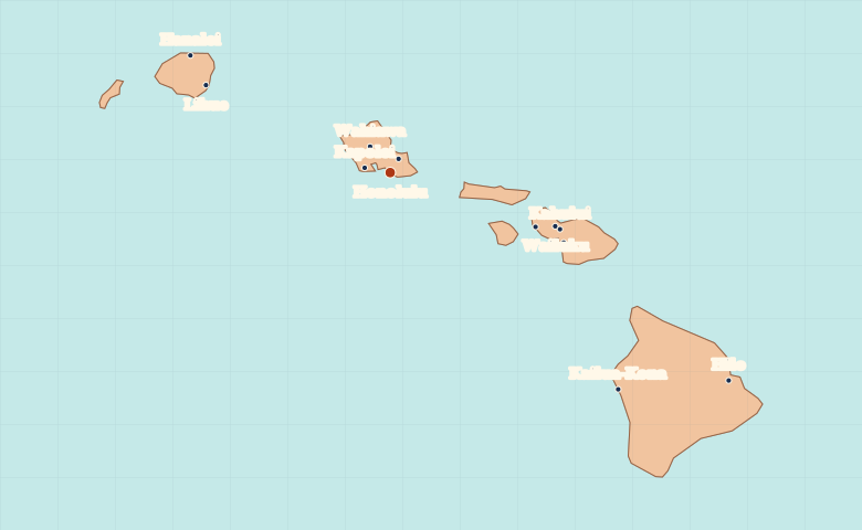
Map of Hawaii with cities
Find Honolulu, Hilo, Kailua-Kona and Kahului on Hawaii’s main islands and compare the locations of towns across the island chain. City index (12) · Map questions
HawaiiCity map
● Capital● City
Reading the map
Cities and towns on the main Hawaiian Islands
The city map focuses on the main islands. Find Honolulu on Oahu, then go southeast to Kahului on Maui and Hilo on the island of Hawaii. Kailua-Kona lies on the opposite side of that island from Hilo. Lihue is northwest of Oahu on Kauai.
| City | Direction | Straight-line distance |
|---|---|---|
| Hilo | Southeast | 339 km / 211 mi |
| Kailua-Kona | Southeast | 269 km / 167 mi |
| Kahului | East | 152 km / 95 mi |
| Lihue | Northwest | 173 km / 108 mi |
Hawaii map questions
Are Honolulu and Hilo on the same island?
Honolulu is on Oahu. Hilo and Kailua-Kona are on opposite sides of the island of Hawaii. Kahului is on Maui, between Oahu and Hawaii.
How far apart are Hilo and Kailua-Kona?
Kailua-Kona is about 95 km (59 mi) west of Hilo in a straight line between their map markers. Road distances depend on the route.
Cities on this map (12)
- Hanalei
- Hilo
- Honolulu
- Kahului
- Kailua-Kona
- Kaneohe
- Kapolei
- Kihei
- Lahaina
- Lihue
- Wahiawa
- Wailuku