United States / City maps
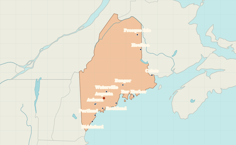
Map of Maine with cities
Locate Portland, Bath and Rockland on Maine’s coast. Explore inland from Augusta and Bangor to Presque Isle in the north. City index (13) · Map questions
MaineCity map
● Capital● City
Reading the map
The Atlantic ports and the northern interior
Portland, Bath and Rockland mark different stretches of the coast. Augusta is inland on the Kennebec, and Bangor lies farther northeast on the Penobscot. Compare coastal Bar Harbor with Presque Isle deep in northern Maine.
| City | Direction | Straight-line distance |
|---|---|---|
| Portland | Southwest | 80 km / 50 mi |
| Bangor | Northeast | 96 km / 60 mi |
| Presque Isle | Northeast | 297 km / 184 mi |
| Bar Harbor | East | 126 km / 78 mi |
Maine map questions
Which Maine cities are inland from the coast?
Augusta is inland on the Kennebec River and Bangor is inland on the Penobscot. For comparison, Rockland and Bar Harbor sit on the coast.
How far apart are Portland and Bangor?
Bangor is about 172 km (107 mi) northeast of Portland in a straight line between their map markers. Road distances depend on the route.
Cities on this map (13)
- Auburn
- Augusta
- Bangor
- Bar Harbor
- Bath
- Biddeford
- Calais
- Houlton
- Lewiston
- Portland
- Presque Isle
- Rockland
- Waterville