United States / City maps
Map of New Hampshire with cities
Follow the Merrimack from Concord through Manchester to Nashua, then locate Portsmouth on New Hampshire’s short Atlantic coastline. City index (12) · Map questions
New HampshireCity map
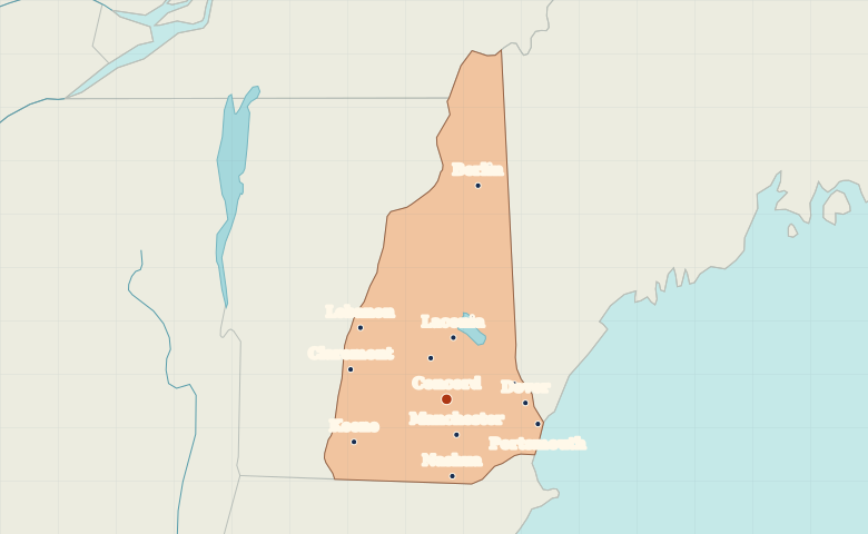
● Capital● City
Reading the map
The Merrimack Valley and the Seacoast
From Concord, follow the Merrimack south to Manchester and Nashua. Portsmouth marks the short Atlantic coast. Keene lies in the southwest, Lebanon near the Vermont border, and Berlin north of the White Mountains.
| City | Direction | Straight-line distance |
|---|---|---|
| Manchester | South | 25 km / 15 mi |
| Nashua | South | 51 km / 32 mi |
| Portsmouth | East | 64 km / 40 mi |
| Keene | Southwest | 69 km / 43 mi |
New Hampshire map questions
Which New Hampshire city is on the Seacoast?
Portsmouth is on the tidal Piscataqua River near its Atlantic mouth. Concord, Manchester and Nashua are inland along the Merrimack.
How far apart are Manchester and Nashua?
Nashua is about 28 km (17 mi) south of Manchester in a straight line between their map markers. Road distances depend on the route.
Cities on this map (12)
- Berlin
- Claremont
- Concord
- Dover
- Franklin
- Keene
- Laconia
- Lebanon
- Manchester
- Nashua
- Portsmouth
- Rochester