United States / City maps
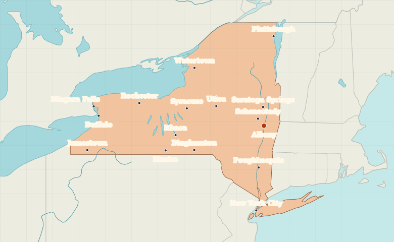
Map of New York State with cities
Explore New York State from New York City up the Hudson to Albany, then west to Syracuse, Rochester and Buffalo. City index (16) · Map questions
New YorkCity map
● Capital● City
Reading the map
The Hudson Valley, Great Lakes and New York City
Start at New York City and trace the Hudson Valley north through Poughkeepsie to Albany. Syracuse, Rochester and Buffalo form an east-to-west sequence across upstate New York. Plattsburgh lies to the northeast on Lake Champlain.
| City | Direction | Straight-line distance |
|---|---|---|
| New York City | South | 216 km / 134 mi |
| Buffalo | West | 419 km / 260 mi |
| Rochester | West | 320 km / 199 mi |
| Syracuse | West | 200 km / 124 mi |
New York map questions
Where is Albany relative to New York City?
Albany is north of New York City, up the Hudson River. Poughkeepsie lies along the valley between them.
How far apart are New York City and Buffalo?
Buffalo is about 471 km (293 mi) northwest of New York City in a straight line between their map markers. Road distances depend on the route.
Cities on this map (16)
- Albany
- Binghamton
- Buffalo
- Elmira
- Ithaca
- Jamestown
- New York City
- Niagara Falls
- Plattsburgh
- Poughkeepsie
- Rochester
- Saratoga Springs
- Schenectady
- Syracuse
- Utica
- Watertown